
HISTORICAL MAPS · 1402 (ORIGINAL, LOST); THIS COPY LATER 15TH–16TH CENTURY
The Kangnido
A Korean map that showed Africa as a sailable continent decades before Europeans rounded it, and placed Europe and the Mediterranean on the far left of the world.
- Made by
- Commissioned from Kwŏn Kŭn (1352–1409) by royal decree; later copy
- Date
- 1402 (original, lost); this copy later 15th–16th century
- Held by
- This copy: Honkō-ji Tokiwa Museum of Historical Materials, Shimabara, Japan
- Medium
- Ink and colour; this copy about 220 × 289 cm
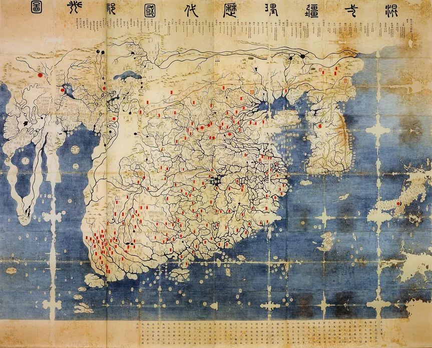
Loading the annotated map…